Sign In
December 14, 2023
Hydraulic engineering meets digital innovation at Van den Herik
Enhancing quality, lowering risk
The applications used at Van den Herik currently serve to enhance the quality and efficiency for tenders and projects. It not only gives them a competitive advantage when applying to a new project, but it also lowers the risk of making wrong cost estimations. So far, they have successfully used their applications on several projects. For example, the tools for waterway routes and water info analysis are being used for almost all tenders.
General and project-specific tools
Besides apps for waterway routes and water info analysis, Van den Herik has one more general tool for determining the type of geotextile that should be used on the soil. Two other project-specific tools are for analyzing sensor data and predicting dredging work.
Optimizing waterway routes
This application is also referred to as Van den Herik’s Google Maps for waterways. The app is used to determine the fastest route from point A to point B, which boats are allowed to navigate a certain route, and what the most optimal route is when more locations (e.g. 20) should be visited. “This is a great example of how we automate the boring! Sometimes, we must dredge in 30 locations and dump in 20 possible locations based on soil type and quality. With 600 possible routes, it can become quite complex and laborious to manually determine what the optimal routes are. This tool lets you optimize this process in minutes, saving cost along the way as you use far less fuel.”
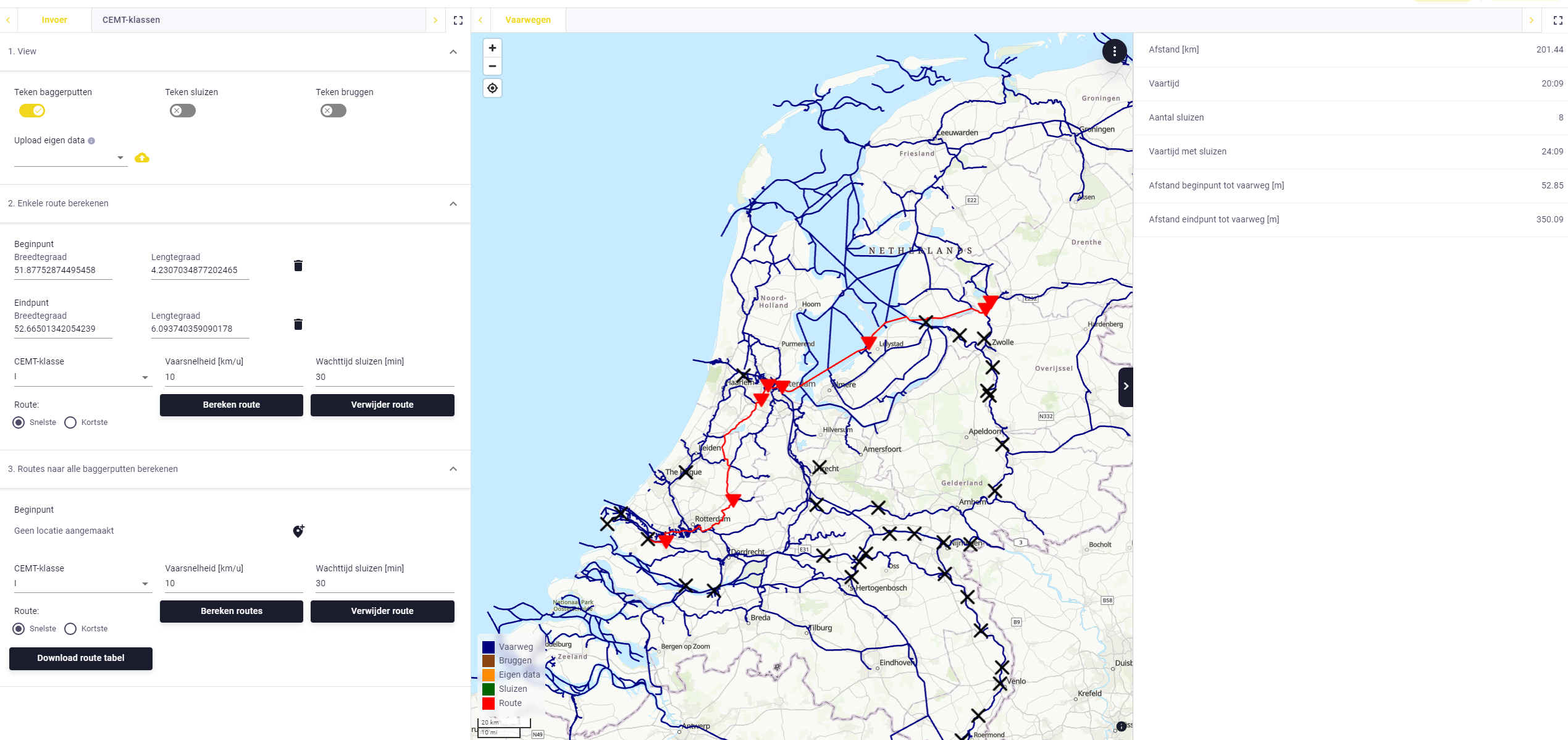 Screenshot of Herik Maps, the application to calculate waterway routes
Water info analysis
Using the Rijkswaterstaat Waterinfo website, Van den Herik retrieves historical data on water levels and currents across the Netherlands. This data is important for the firm, for example, to determine expected workability in certain time windows. However, requesting data from the past 10 years generates enormous .csv files with tens of millions of lines of data. Especially when requesting multiple measuring points. That is why Roga developed an application that connects to Rijkswaterstaat’s API to retrieve these files within minutes, rather than hours, that are ready to be analyzed. The app also filters the data and allows users to create plots and graphs on the course of water levels and currents, which was not possible before using Excel.
Geotextile
Oftentimes underwater constructions need soil protection afterwards to ensure the soil remains as it is. For this, a wide variety of different ‘geotextiles’ and alternatives can be used. Previously, to decide which geotextile was suited the design department at Van den Herik used spreadsheets. However, these can be quite complicated. Especially, for people with less knowledge of the topic. Instead, with the geotextile application, work planners can fill in a list of all environmental factors and the app will provide a suggestion of which geotextile is most suited within five minutes, including a template for a design report that can be submitted to the client.
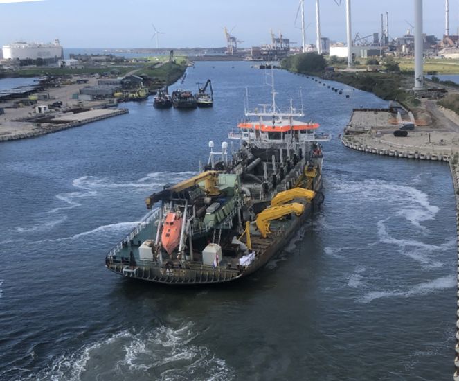
Dredging at Zeesluis IJmuiden
Currently, Van den Herik is working on a large maintenance project at Zeesluis IJmuiden where they are responsible for maintaining the right soil levels for the upcoming 20 years. They are developing an application that will predict how the underwater soil will develop. This is done using bi-weekly measurement data on which machine learning will be applied to discover trends and create links to environmental factors, such as water heights and weather conditions. This way, they can predict when and how often dredgers must be sent to the location. Van Den Herik intends to apply the lessons they learned in using machine learning to assist in dredging operations and, more generally, in optimizing dredging strategies for other projects in the future.
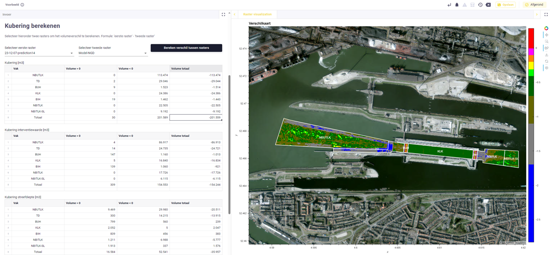 Screenshot from the Dredgin Predictions application used to predict soil developments at Zeesluis IJmuiden
Not a software developer
Despite the great number of tools being developed at Van den Herik, they do not define themselves as a software development organization “And we never will become one”, adds Roga. “However, we can leverage our means to create software that enables us to deliver more quality. Something we had never foreseen to be possible in the first place.”
“In conversations with VIKTOR, we appeared to be a great match. Short lines, fast fixes, and feedback gets processed quickly. Everything is based on parameters, which makes creating apps much easier. But the code you write is not linked to the platform and can be repurposed at any time.” – Lloyd Roga, GIS specialist at Van den Herik.
More engineering tools
Besides their own custom collection of web apps, Van den Herik also uses several pre-existing VIKTOR tools. For example, GeoTools: a set of tools that helps save time and make geotechnical data more insightful, the BRO app to assess the soil in combination with their own Geotextile app, the CPT interpreter to view .gef files in graphs and GIS maps, and the Document Searcher to find and access any information in (engineering) documents. The last is used on every project; all documents are uploaded so everyone involved can easily search through contract details, fast.
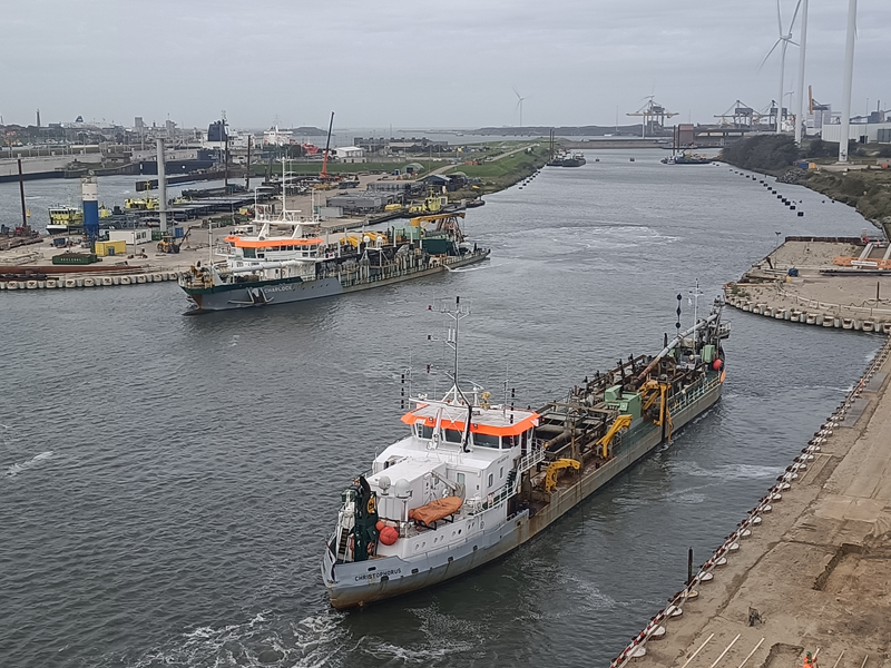 Van den Herik ships Charlock and Christophorus dredging at Zeesluis IJmuiden
